Technical information
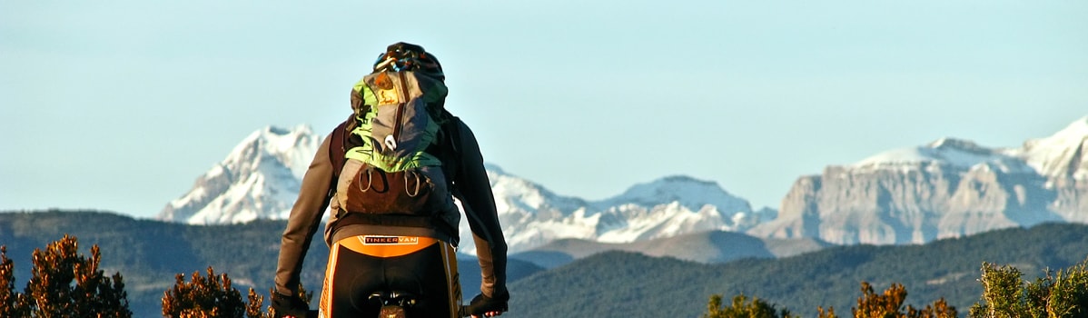
Type of route: circular hiking and mountain bike route
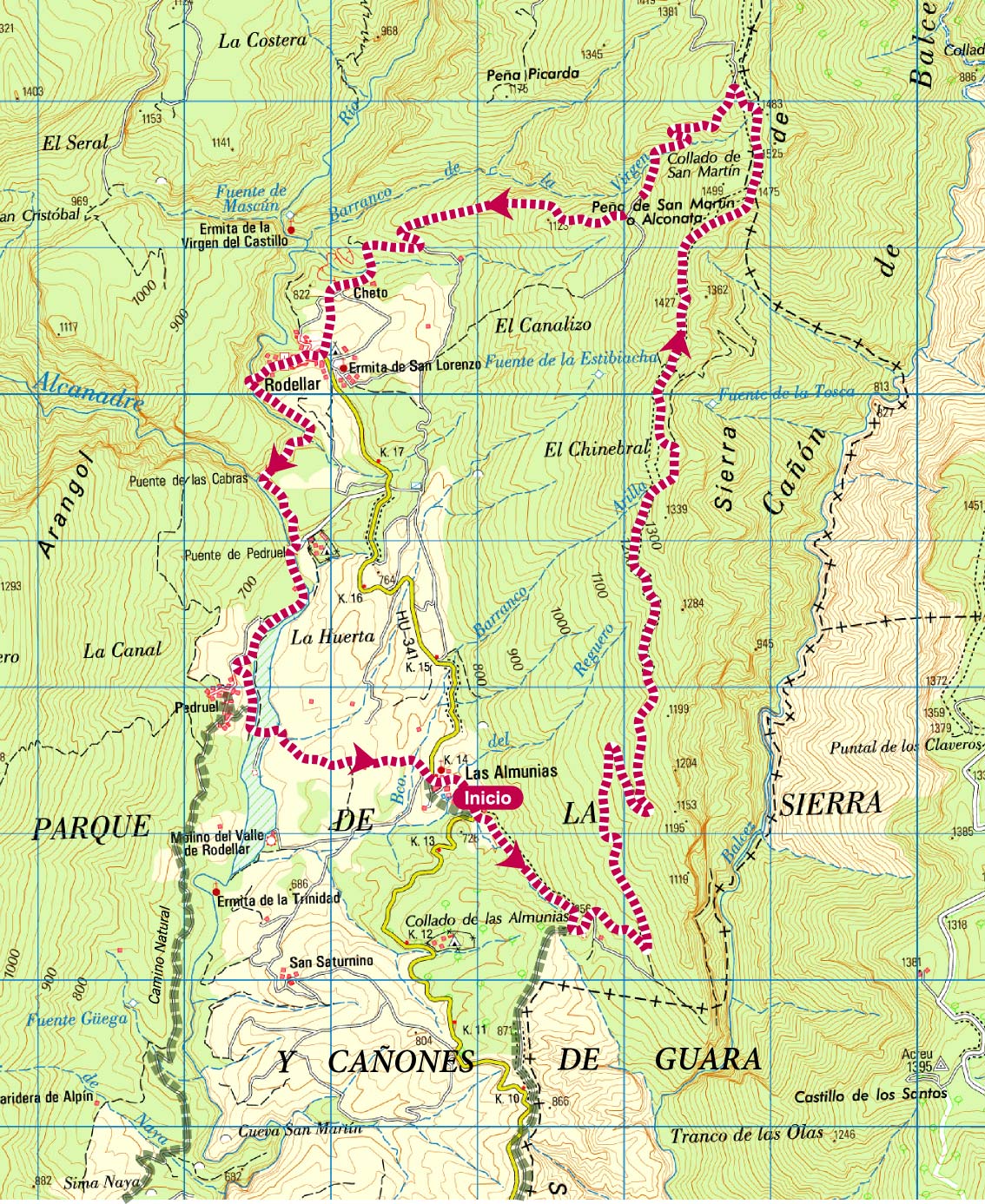
Departure point:: Las Almunias de Rodellar
KM: 20,5
Duration: 8 h
Gradient: 950 m
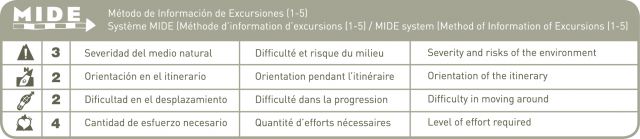
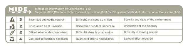
MIDE: 3-2-2-4
Dififculty: +
Poitns of interest
Views of the Pyrenees, the sierras and the ravines of Guara.
Route description
The crest of Balced extends from north to south and sits between the Alcanadre and Isuala rivers. This route is well signposted and offers the visitor an extraordinary opportunity to experience one of the deepest and longest ravines of the Sierra de Guara, known as the Balced canyon. This walk also presents exceptional views of the Pyrenees, the Rodellar Valley and the highest peaks of the Guara Natural Park.
This particular route is linear and can be started from either Rodellar or Las Almunias de Rodellar. As it does not loop back to the original starting point, it is advisable to have more than one car available so that a vehicle can be left at each end of the route.
For those walkers starting the walk in Las Almunias de Rodellar: head out of the village on the main road to Bierge and after 200 metres you will come across a signposted footpath to the left of the road. Walk along this footpath until you arrive at an old track; this was once used by charcoal merchants heading to the mountains. Continue along this track in a northerly direction and as it climbs gently up a west-facing slope you will be rewarded with sweeping views of the Rodellar Valley and the surrounding mountains.
As you get closer to the crest you will find that the track stops suddenly. In its place there is a smaller footpath heading in the same direction, which will take you to the highest point of the walk. From this lofty spot, the grandeur of the Balced canyon can be appreciated in full. The graceful flight of the various birds of prey that make their nests on the ledges of the crest will also impress. Griffon vultures, lammergeyers (also known as bearded vultures) and royal eagles are just a few of the species to be found here.
Following the markers, you will come across an arrow that indicates the descent towards Rodellar. On the way to the village there are a number of well-built dry-stone walls, erected to mark out and protect the paths and the small parcels of cultivated land.
Photo gallery


Map