As the most IMPORTANT thing is your SAFETY, before setting off on any EXCURSION we recommend you follow the directions given by Montaña Segura.
You can also get information and download some basic environmental recommendations for hiking in the Sustainable Somontano section.
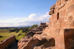
Trail to the Balsas de Basacol (from Alquézar)
- Theme: Culture – Nature
- Visit type: Free
- Time of year: All year round
- Recommended age: From 4 years of age
- Municipality: Alquézar
- Location: Alquézar
- GPS Location: 42.172089, 0.022404 (Route start)
- Web: It is part of Stage 1: Somontano Nature Route
- Route length: 6 km round trip
- Duration of the trail: 2 h 30 m round trip
- Services: Parking – Interpretive panel – Picnic area
- Adapted: No
- Recommendations: Carry water – Mountain footwear
Trail to the Villacantal Bridge (from Alquézar)
- Theme: Culture – Nature
- Visit type: Free
- Time of year: All year round
- Recommended age: From 4 years of age
- Municipality: Alquézar
- Location: Alquézar
- GPS Location: 42.174362, 0.025322 (Route start)
- Web: It is part of Stage 1: Somontano Nature Route
- Route length: 4 km round trip
- Duration of the trail: 2 h round trip.
- Services: Interpretive panel
- Adapted: No
- Recommendations: Carry water – Mountain footwear
- Theme: Culture – Nature
- Visit type: Free
- Time of year: All year round
- Recommended age: From 3 years of age
- Municipality: Naval
- Location: Naval
- GPS Location: 42.194507, 0.150874 (Route start)
- Web: Camino de la Sal trail
- Route length: 2 km 700 m round trip
- Duration of the trail: 1h round trip.
- Services: Parking – Interpretive panel – Picnic area
- Adapted: No
- Recommendations: Carry water – Suitable footwear
Trail to the cave art shelter in Forau del Cocho
- Theme: Culture – Nature
- Visit type: Free
- Time of year: All year round
- Recommended age: From 5 years of age
- Municipality: Estadilla
- Location: Estadilla
- GPS Location:
- Start of the trail next to the Shrine Santuario de la Carrodilla: 42.052063, 0.302232
- Cave art shelter in Forau del Cocho: 42.055660, 0.305373
- Web: Trail to the cave art shelter in Forau del Cocho
- Route length: In Estadilla, you must take the unpaved track that leads to the Shrine Santuario de la Carrodilla. The whole journey can be done by car. Shortly before arriving at the Shrine, you will find the starting point of the trail. It’s an 850-metre walk to reach it.
- Duration of the trail: 15 min. going from the Sanctuary of the Carrodilla
- Services: Parking – Interpretive panel – Picnic area
- Adapted: No
- Recommendations: Carry water – Suitable footwear