Olvena - Rutas
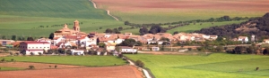
Olvena
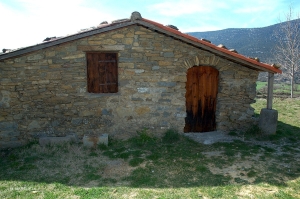
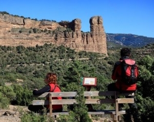
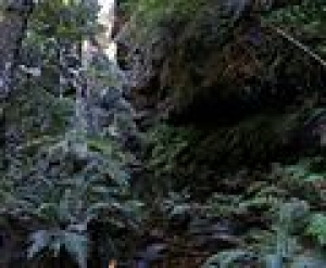
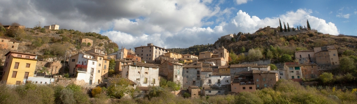
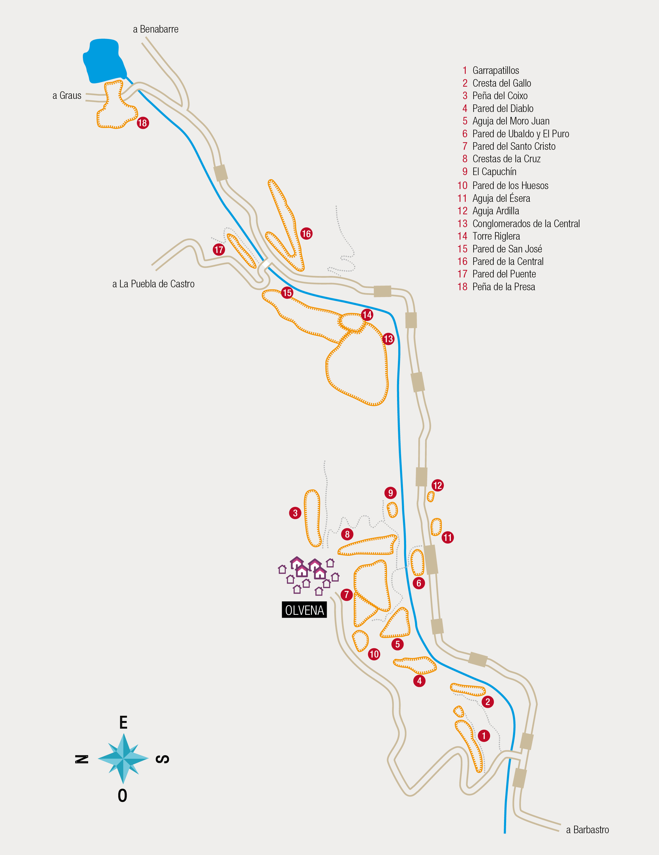
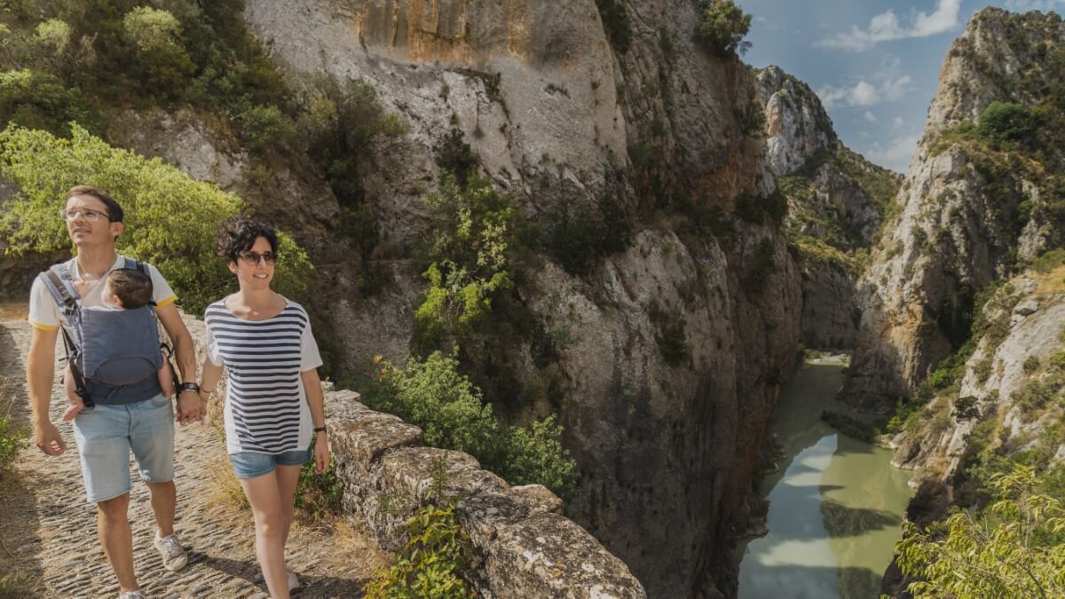
Olvena Canyon is located in Southern Pyrenees and was formed by Ésera river in the area between Graus and Barbastro. It is 8 km long and features numerous walls and needles of top quality limestone rock combined with some conglomerate zones. It includes more than 20 different climbing areas and there are many possibilities of opening new ones. N-123 road runs along the canyon giving easy access to almost all sectors. There is also a local road giving access to Olvena village located on top of the rocks.
Olvena is known for combining good sport climbing areas such as Garrapatillos Alto and Garrapatillos Bajo as well as Crestas de la Cruz with multi-pitch climbing routes such as Pared del Santo Cristo (where the popular Frixis stands out).
Technical information
- Rock type: limestone
- Number of routes: 120
- Grade: IV+/8
- Length: Up to 200 m
- Face: All
- Season: All year round
Photo gallery


Map
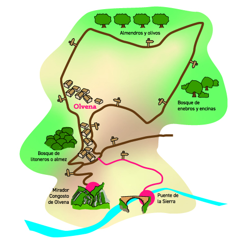
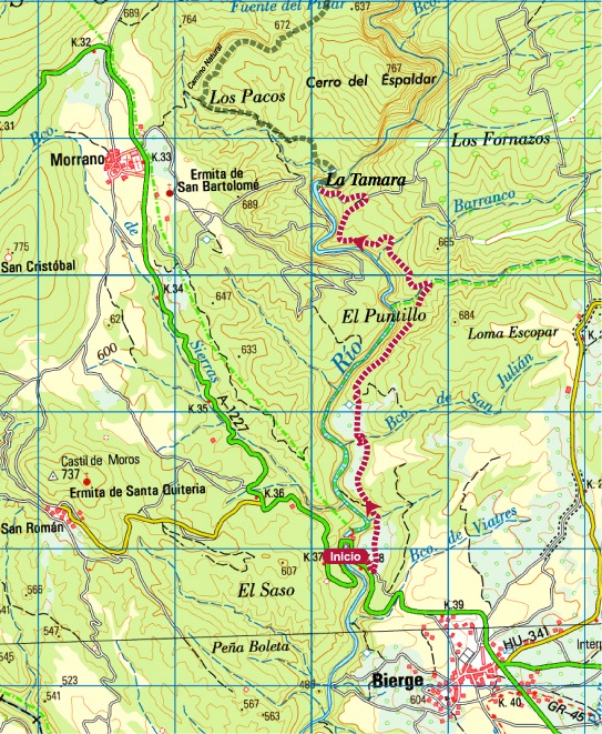
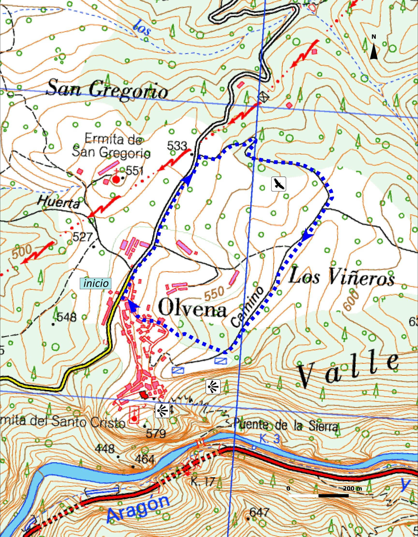
Route Gorge of Olvena
Technical information
Type of route: circular hiking route
Punto de inicio: Olvena
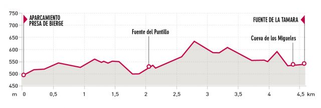
KM: 2,2
Duration: 40 min
Gradient: 40 m
MIDE: 1-2-1-1
Difficulty:

Access
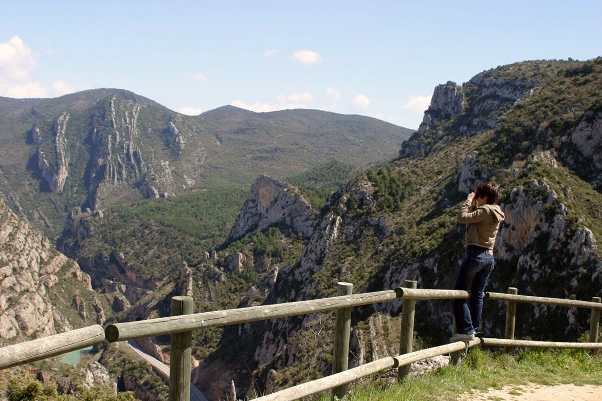
In Olvena follow the road A-2211 to Puebla de Castro. At about half a kilometre, make a right turn onto a dirt track, walk for about 600 metres and return along a track parallel to the road and the mountain pass which leads to the village (2,2 km in total). In addition, it is possible to stop at the Congosto balcony and in “Camino del Canaíllo” to better enjoy the views of the gorge and the rocky birds living there.
Route description
Circular route of 2,2 km. It starts covering 500 metres on the road from Olvena to Puebla de Castro, we then turn right onto a dirt track and, after about 600 metres, we take another track heading South that will lead us back to Olvena.
The route passes through cultivated fields, near the gorge, and it is easy to observe large predators that use these agricultural fields as forage area. We also recommend approaching the balcony of Congosto and the “Camino del Canalillo” to have best views of the gorge and the rocky birds living there.
Main Species
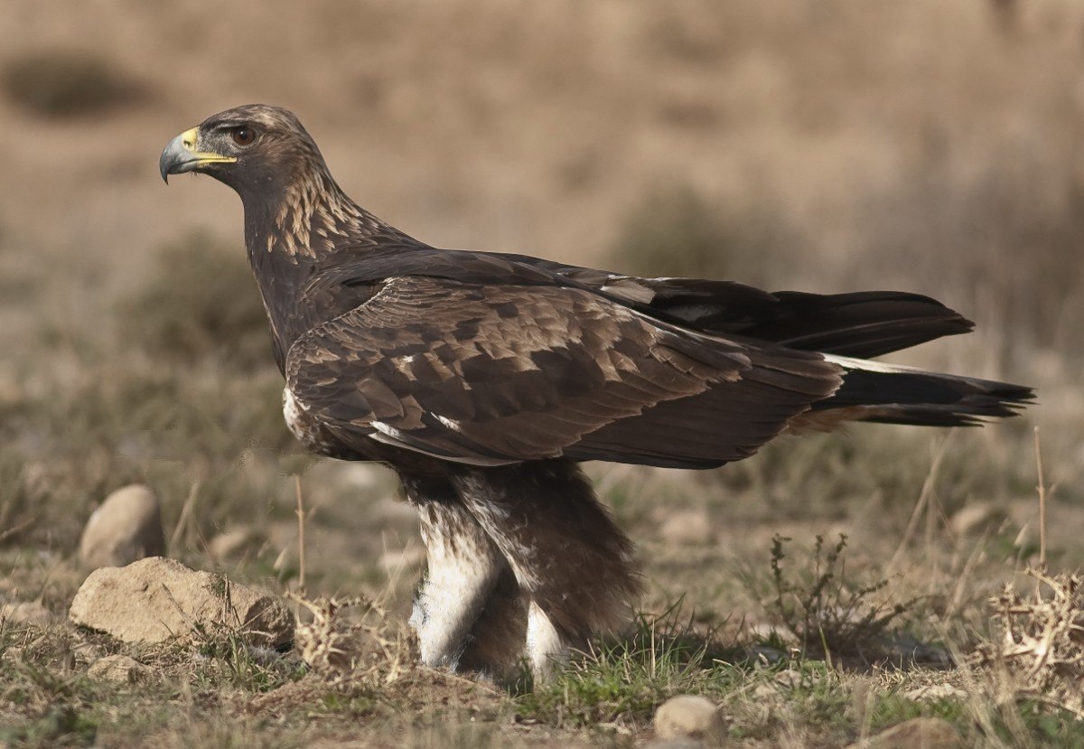
Representative bird: Golden Eagle (Aquila chrysaetos)
Residents: Red-legged Partridge, Red Kite, Griffon Vulture, Eurasian Sparrowhawk, Common Buzzard, Common Kestrel, Peregrine Falcon, Golden Eagle, Bonelli’s Eagle (rare), Rock Dove, Stock Dove, Wood Pigeon, Eagle Owl (rare), Little Owl, Long-eared Owl, Hoopoe, Green Woodpecker, Great Spotted Woodpecker, Crested Lark, Thekla Lark, Wood Lark, Crag Martin, Pied Wagtail, Eurasian Wren, European Robin, Black Redstart, Blue Rock Thrush, Mistle Thrush, Blackbird, Dartford Warbler, Sardinian Warbler, Common Firecrest, Long-tailed Tit, Crested Tit, Coal Tit, Blue Tit, Great Tit, Eurasian Jay, Magpie Eurasian Jackdaw, Carrion Crow, Common Raven, Spotless Starling, Common Starling, House Sparrow, Eurasian Tree Sparrow, Rock Sparrow, Chaffinch, European Serin, European Greenfinch, European Goldfinch, Linnet, Cirl Bunting, Rock Bunting, Corn Bunting.
Summer migrants: Black Kite, Egyptian Vulture, Short-toed Snake Eagle, Booted Eagle, European Turtle Dove, Common Cuckoo, Red-necked Nightjar, Common Swift, Alpine Swift, European Bee-eater, Barn Swallow, House Martin, Common Nightingale, Black-eared Wheatear, Common Rock Thrush, Melodious Warbler, Subalpine Warbler, Western Orphean Warbler, Bonelli’s Warbler, Spotted Flycatcher, Eurasian Golden Oriole, Woodchat Shrike.
Winter visitors: Northern Goshawk, Merlin, Eurasian Skylark, Meadow Pipit, Alpine Accentor, Fieldfare, Song Thrush, Eurasian Blackcap, Chiffchaff, Goldcrest, wallcreeper (rare), Brambling (rare), Eurasian Siskin (irruptive), Hawfinch, Yellowhammer.
Passage migrants: European Honey-buzzard, Harriers, Common Crane, Eurasian Woodcock (rare), Tree Pipit, Water Pipit, Common Redstart, Northern Wheatear, Redwing, Willow Warbler, Garden Warbler, Common Whitethroat, Pied Flycatcher.
Photo gallery


Map
Nature Observation Trails

The Pre-Pyrenees (which constitute the outer ranges of the Pyrenees mountains) and the Somontano region (which lies in the foothills of the Pyrenees ) are the two geomorphic units that mark the transition between the Mediterranean and Atlantic climate zones. This implies the observation of a wide biodiversity of species both in terms of flora and fauna. You may come across species on the same excursion that are many kilometers apart in Europe, such as holm-oak groves (Quercus ilex) together with Scots pine forests (Pinus silvestrys), or rosemary (Rosmarinus oficinalis) together with Pyrenean-violets (Ramonda myconi).
The proposed trails will lead us through a contrast of landscapes, from the arid steppes of the south of the Somontano region to the rocky limestone peaks of the pre-Pyrenees, in less than 50 km. This will allow us to discover four different habitats including steppe, riverbank, the Somontano region, and the Pre-Pyrenees.
- Mediterranean Landscape. Adahuesca
- Harmony in the contrasts. Alquézar
- Oligocene Gypsums and the Barbastro Anticline. Barbastro
- The Estada Diapir. Estadilla - Estada
- Rocky outcrops, tabletop hills and sandstone cliffs in la Clamor Valley. El Tormillo
- Geobotanical Walk. Olvena
- The Orchid Garden. Pozán de Vero - Castillazuelo
- River Canyons in the Gulley of the Virgin. Rodellar
- Torreta Hill. Salinas de Hoz
Below, you can download our nature calendar which explains the species of flora and fauna that are common for each month the year.
Discover the landscapes of Guara Somontano 365 days a year!


Ruta Congosto de Olvena
Ficha Técnica
Ruta para familias con niños (mayores de 4 años)
Tipo de ruta: circular
Punto de inicio: Olvena
KM: 2,2
Duración: 1 h 30 min
Desnivel: 80 m
Dificultad: fácil
Tipo de terreno: sendero, pista y pavimento
Época recomendada: durante todo el año
Descripción y estado del sendero
Pavimento rígido, sendero y pista. Pavimento rígido, sendero y pista. El sendero parte desde la población de Olvena, hacia La Puebla de Castro por la carretera local para continuar sobre pista y ya de vuelta de nuevo al pueblo se asciende por un firme pavimentado hacia el Mirador. En la última parte unos escalones nos darán acceso a dicho mirador.
Señalización/Orientación
La ruta no posee ningún tipo de señalización a excepción de la subida al Mirador de Olvena, en el cual existe un cartel interpretativo del paisaje.
Descripción de la ruta
Estáis a punto de iniciar una ruta circular de unos 2,2 km de recorrido, muy sencilla y cómoda para realizar con toda la familia. Comienza la marcha desde la misma población de Olvena en dirección a La Puebla de Castro siguiendo la carretera local a través de campos de cultivo. Pronto encontraréis una pista a la derecha por la que iréis ascendiendo suavemente. Almendros y olivos os acompañarán hasta otra nueva pista que os devolverá al pueblo. Todos esos arbustos que estáis viendo son enebros (Juniperus oxicedrus) muy comunes en toda la zona. Pero tened cuidado, porque sus hojas son afiladas como espinas.
En cuanto lleguéis de nuevo al pueblo, dirigíos hacia el mirador, siguiendo las indicaciones que os llevarán hasta una cuesta asfaltada algo empinada. Pero no desistáis, porque la vista desde arriba es todo un regalo. Nada más llegar, impresiona la visión del Congosto de Olvena. Un congosto es un desfiladero entre montañas y en este caso se ha formado por la acción erosiva del río Ésera. Es tan especial que está catalogado como Punto de Interés Geológico. Desde el Mirador también podréis observar a vuestra izquierda una pared rocosa donde tiene su nido el buitre leonado. Podéis ver los posaderos a simple vista. Solo tenéis que buscar esas manchas blancas en la roca que no son otra cosa que los excrementos de los buitres.
Galería de imágenes


Mapa