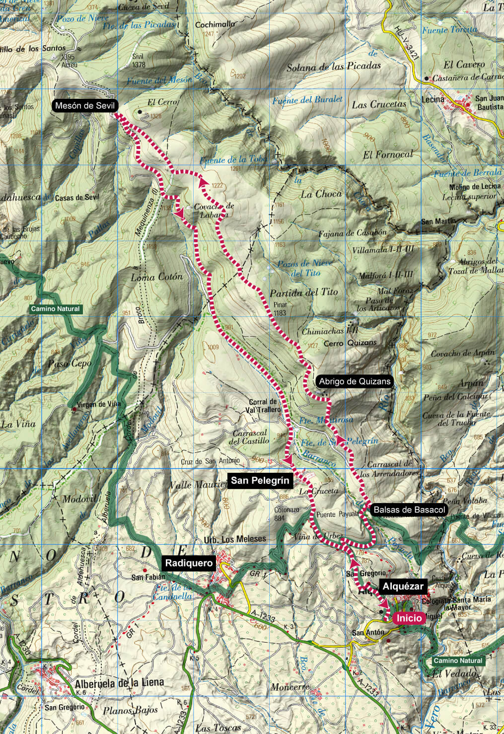
Technical information
Type of route: circular
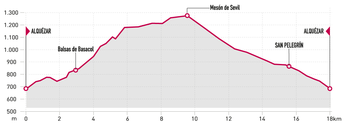
Departure point: Alquézar
KM: 18,1
Duration: 4 h
Gradient: 640 m
Difficulty:
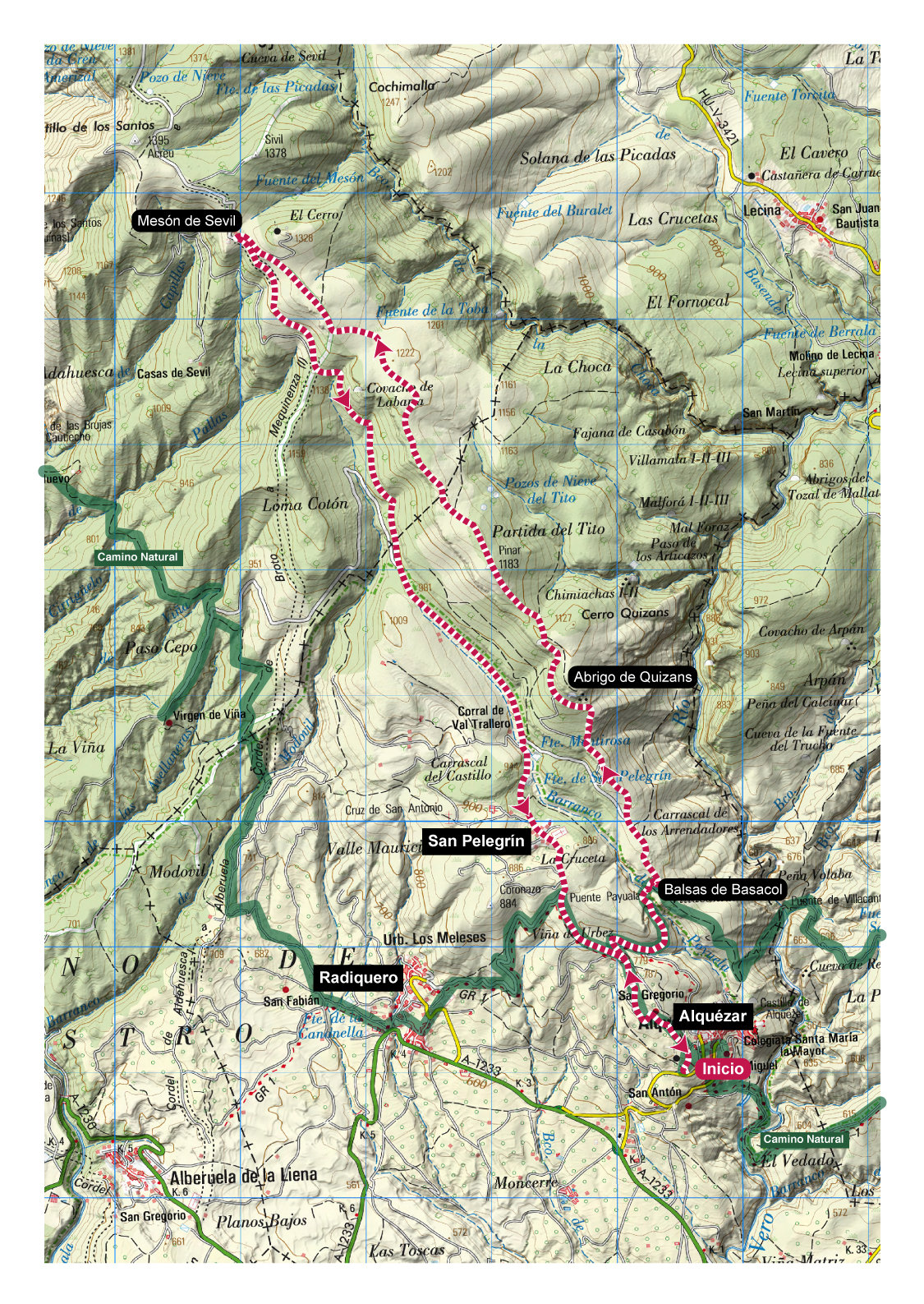
Points of interest
Balsas de Basacol, Quizáns shelter and the villages of Alquézar, Radiquero and San Pelegrín.
Route description
This long-distance route combines sections of forest track with short stretches of stony path typical of theSierra de Guara.
There are beautiful panoramic views to enjoy, from the Vero river canyon to the Pyrenees to the Somontano plains.
Starting from the car park in Alquézar, the route startsgoing uphill along a track to San Gregorio, and shortly after it joins the Camino Natural del Somontano until it reaches the Balsas de Basacol. From there, the route gains altitude, alternating between sections of track and path, passing by the shelters of Quizans and some oldshepherds’ huts. At the Mesón de Sevil, a well-deserved rest undercover is in order. From there, you’ll fi nd a descent along a track inexcellent condition down to Alquézar.
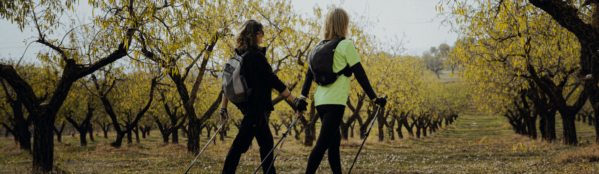
Photo gallery


Map