Technical information
Type of route: circular hiking and mountain bike route
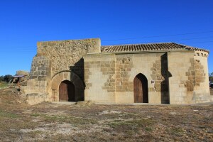
Departure point: Castillazuelo, Centro Interpretación Río Vero.
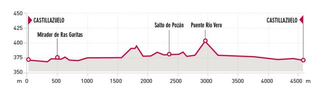
KM: 4,5
Duration: 1h 50 min
Gradient: 50 m
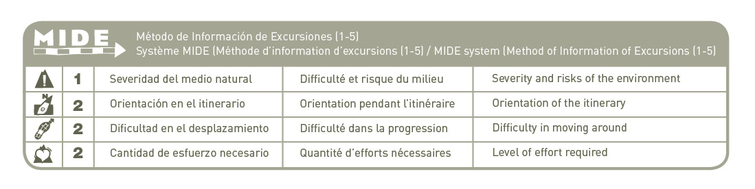
MIDE: 1-2-2-2
Difficulty:
Points of interest
Pozán mill dam, the San Marcos aqueduct (16th c.), riverside flora and fauna.
Route description
Take the steep asphalted street from next to the River Vero Visitor Centre, and after a few metres on the right, you will notice the sign indicating the start of the ancient Camino de Ras Vals. This historic track was used by the farmers of Castillazuelo to reach fields on the outskirts of the village.
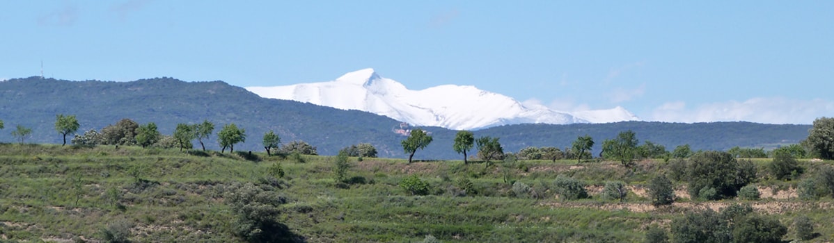
Excellent views over Castillazuelo and the River Vero can be enjoyed beyond the railings that mark the first stretch of the footpath. Then just five minutes from the start of the walk, you will reach the Ras Garitas Viewpoint. An informative panel looks out over the valley and highlights some of the more interesting features that can be seen from the platform.
After leaving the viewpoint, which is located at the highest point of the route, the path begins to descend and winds closer towards the groves of the Vero. Various types of vegetation grow along the banks of the river including willows and poplars. The trees in particular are essential to the river environment, as they help to sustain the animal and plant life, and at the same time protect the banks from the erosion caused by high water currents.
At one point along the path, it is possible to clearly make out furrows in the rocks. These are a result of the hundreds of carts that have passed this way over the years, wearing away the rock as they went. Without leaving the track, you will soon arrive at the old Canal of Castillazuelo.
There is a second footpath just next to the canal; a small detour of around 10 minutes will take you the dam of Pozán, or Pozán Waterfall as it is commonly known.
From the waterfall you must double back along the same footpath until you rejoin the canal. Cross over the River Vero by following the aqueduct and follow the path that runs alongside the left bank of the water, heading back towards Castillazuelo. During this pleasant walk, the beauty and size of the regal gall oaks will contribute to the overall perspective of the valley.
Photo gallery


Map